

From the acrticle:
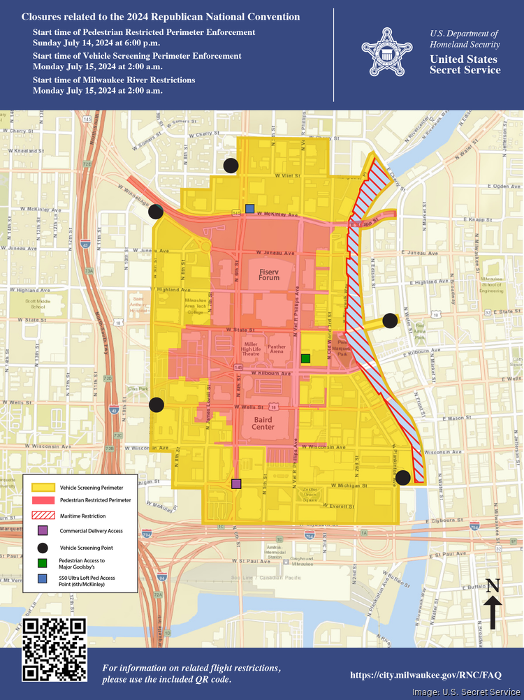
The U.S. Secret Service on Friday revealed maps of the security zones for the upcoming Republican National Convention.
There are two zones that will be located around Fiserv Forum and around Henry Maier Festival Park. The Republican National Convention is scheduled for July 15 through July 18.
The former includes a vehicle restricted zone with boundaries that stretch north to Cherry Street, south to Clybourn Street, west to Ninth Street and east to the Milwaukee River. This outer vehicle screening perimeter (highlighted in yellow in the maps below) is where vehicles will be screened upon entrance but pedestrians are free to access without screening.
A pedestrian screening perimeter (highlighted in red in the maps below) will be accessible only to people attending or working the event.
Pedestrian restricted area enforcement begins Sunday, July 14, at 6 p.m. Vehicle screening perimeter enforcement will begin Monday, July 15, at 2 a.m.
Only one residential building, 550 Ultra Lofts, is in the pedestrian restricted area. Residents will be permitted to access their homes and parking spaces.
Commercial and recreational water travel will not be permitted on the Milwaukee River between Cherry and Michigan streets beginning July 14 and running through the early morning hours of July 19.
So where can I protest?
It looks like Zeidler Union Square or Haymarket Square (which is kind of bullshit)
Nowhere where they’ll see you.