

Message from the Russian Ministry of Defense: “As a result of decisive actions by units of the ‘North’ Group, control has been established over the settlement of Chaikovka in Kharkov Oblast.”
[

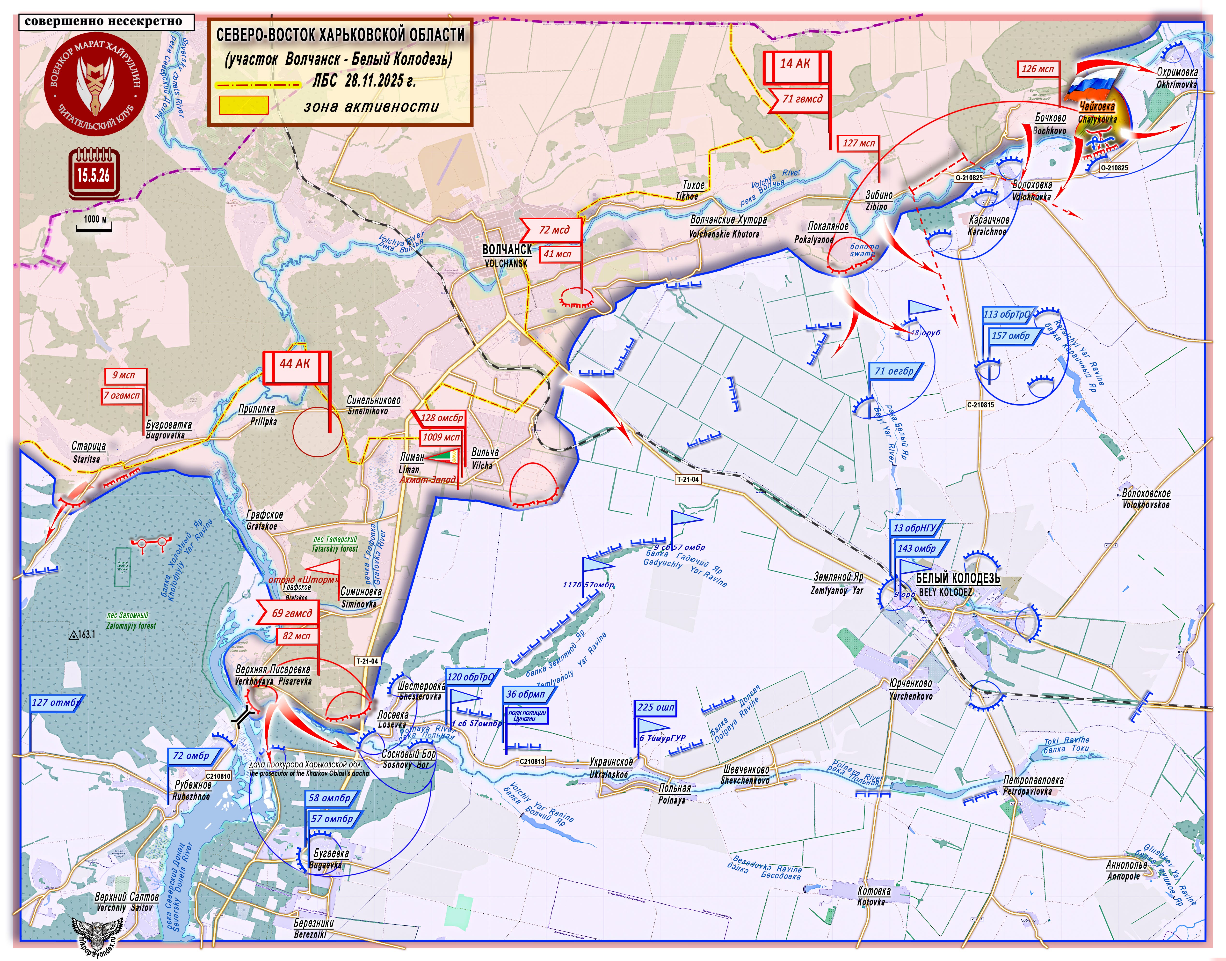
Northeast Kharkov Oblast (Area of Volchansk to Bely Kolodez); (Dashed and dotted line) ЛБС 28.11.2025=Line of Combat Contact November 28th, 2025. Yellow colored area=Area of Activity.
[

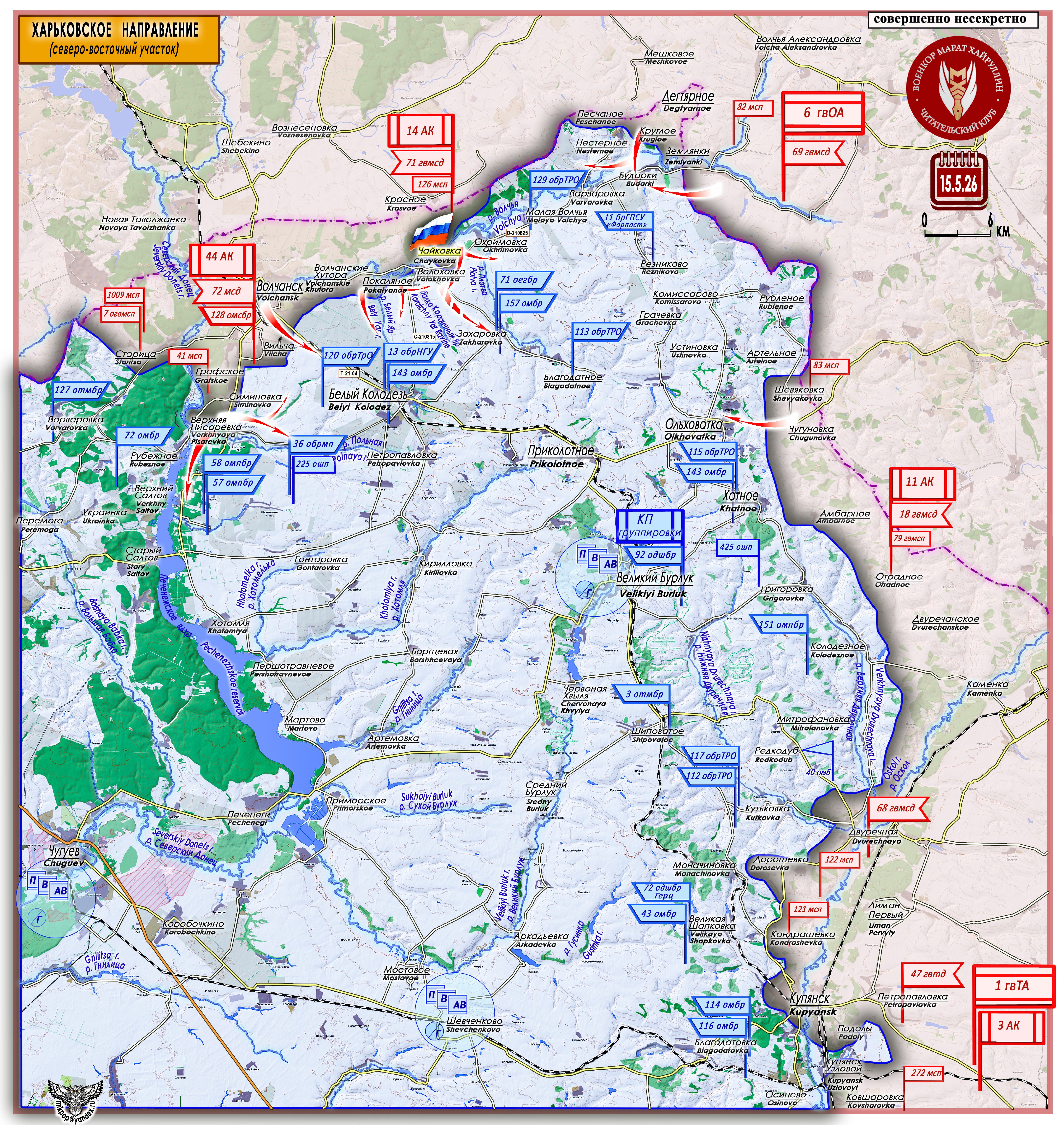
Kharkov Direction (Northeast Area)
On the left flank of the Volchansk sector of the Kharkov direction, on the left bank of the Volchya River, the Ukrainian Armed Forces have several remaining defensive hubs that form and support their entire defensive line. These hubs are: Volokhovka - Karaichnoe, Chaikovka - Okhrimovka - Malaya Volchya, and Nesternoe - Budarki - Varvarovka.
[

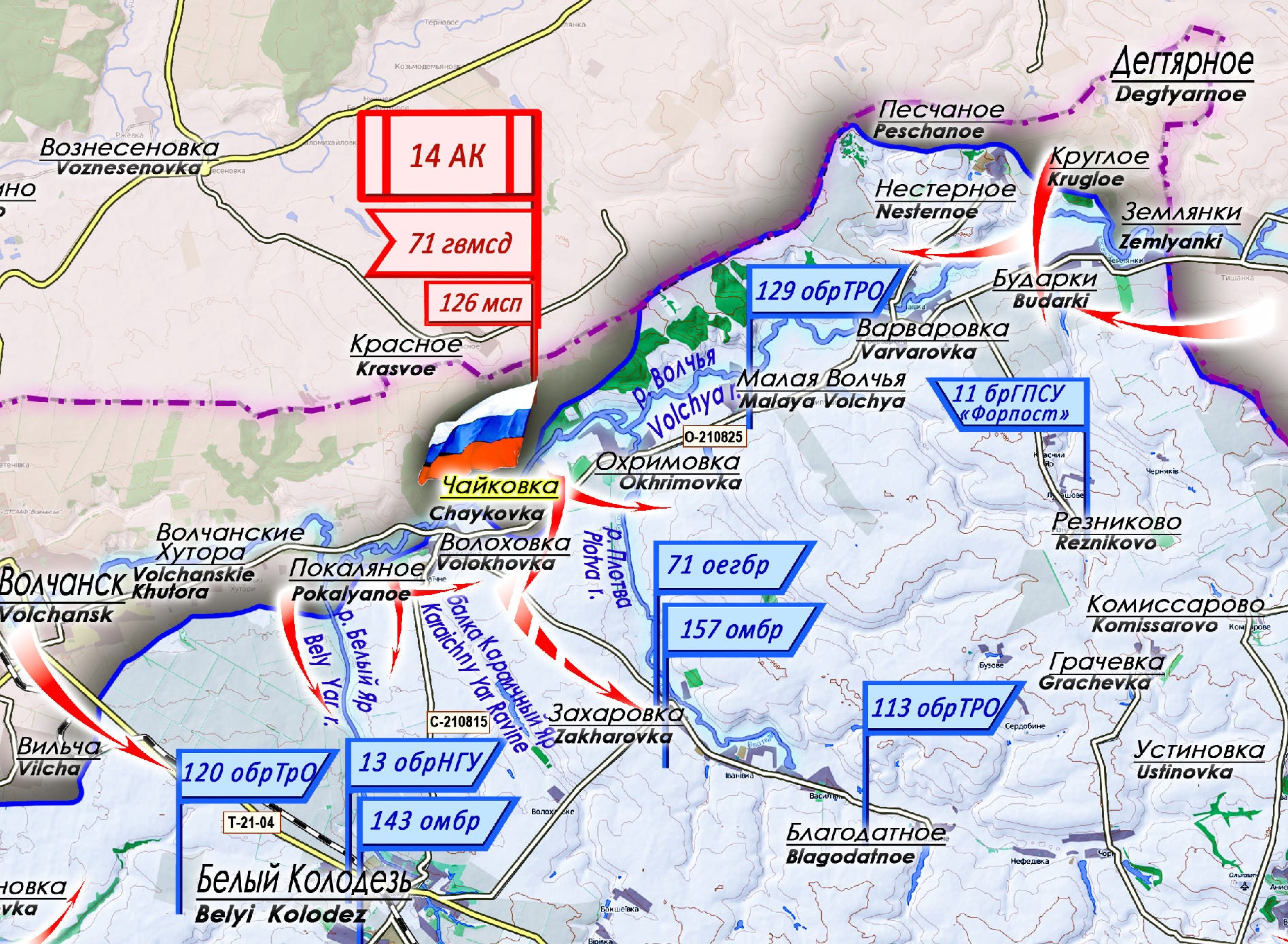
The enemy’s defensive hubs are connected by the O-210825 rocade, to which the radial roads C-210815 (Volokhovka - Bely Kolodez), the dirt roads Volokhovka - Zakharovka, and Budarki - Reznikovo lead.
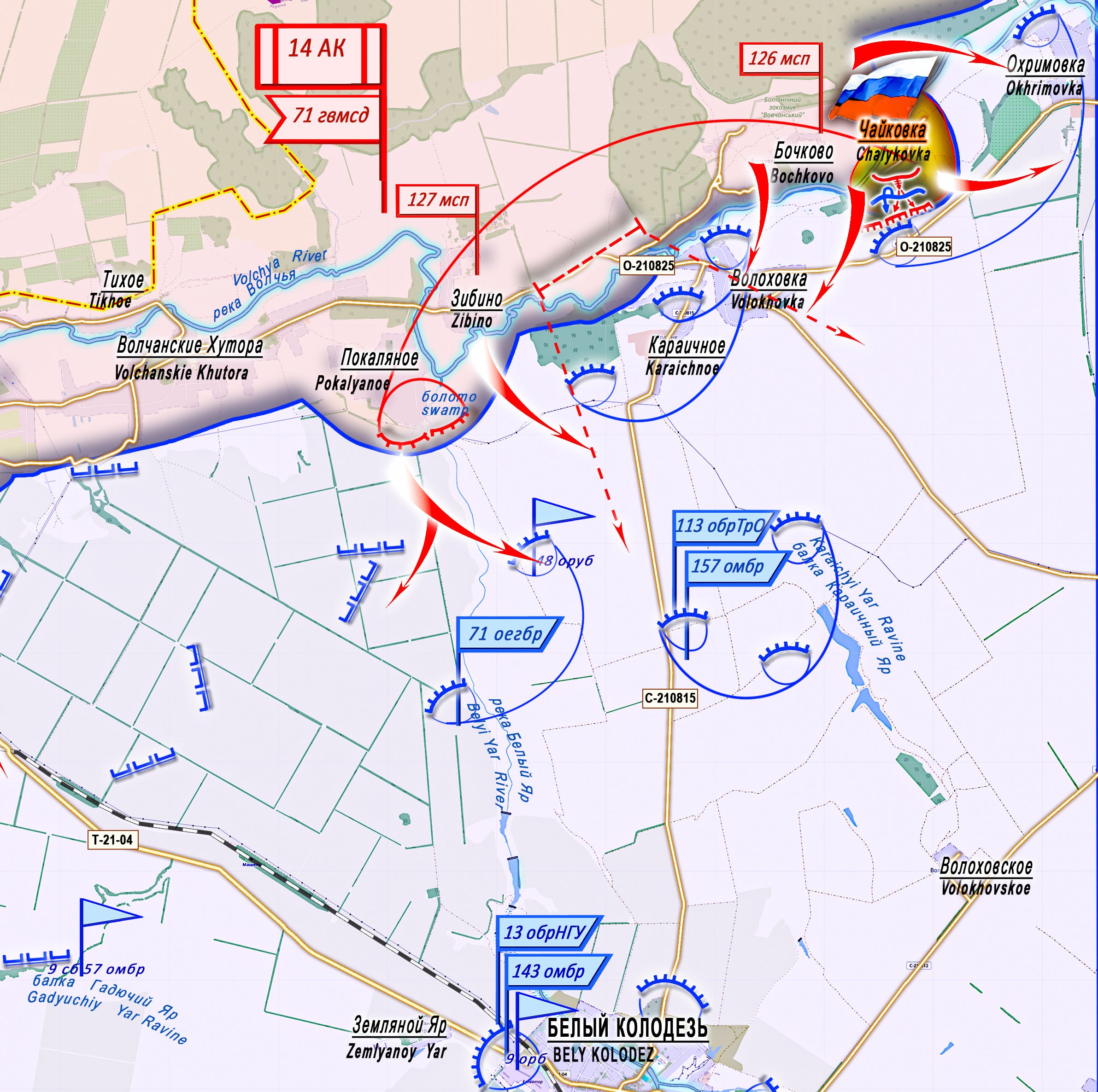
Units of the “North” Group, methodically following their proven tactics of enveloping and dividing the enemy’s forces, are persistently advancing onto the left bank of the Volchya River, forming a wide bridgehead there. On May 15, control was established over the rural settlement of Chaikovka (50°19′20″ N 37°10′19″ E, population 45 in 2001). This is one of the stronghold areas of the Ukrainian Armed Forces’ defensive hub of Chaikovka - Okhrimovka - Malaya Volchya. It is located on the left bank of the river between the settlements of Okhrimovka and Volokhovka.
[

In the center of the settlement is a swamp (about 7 hectares), and 1 kilometer to the south lies the O-210825 rocade. Russian assault units have taken positions on the flanks of two Ukrainian defensive hubs, with the ability to split them and execute flanking/ outflanking maneuvers against the defense areas of Volokhovka and Okhrimovka, and have now cut their coordination along the rocade.
Note: “Rocades” are roads that run parallel to the front line.
Message from the Russian Ministry of Defense: “Units of the ‘East’ Group continued their advance into the depth of the enemy’s defense and over the past 24 hours have liberated the settlement of Charivnoe in Zaporozhye Oblast.”
[

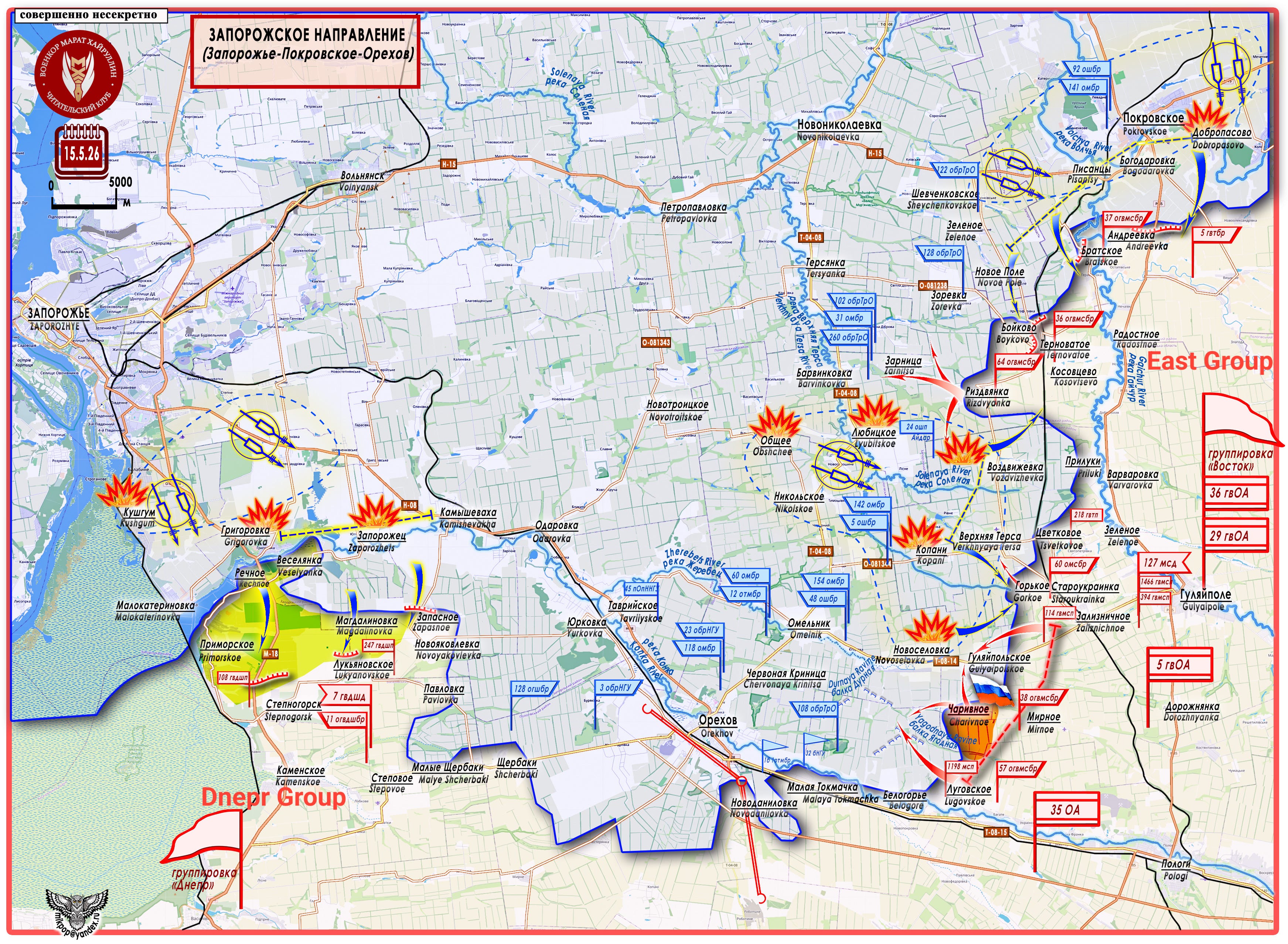
Zaporozhye Direction (Zaporozhye-Pokrovskoe-Orekhov)
[

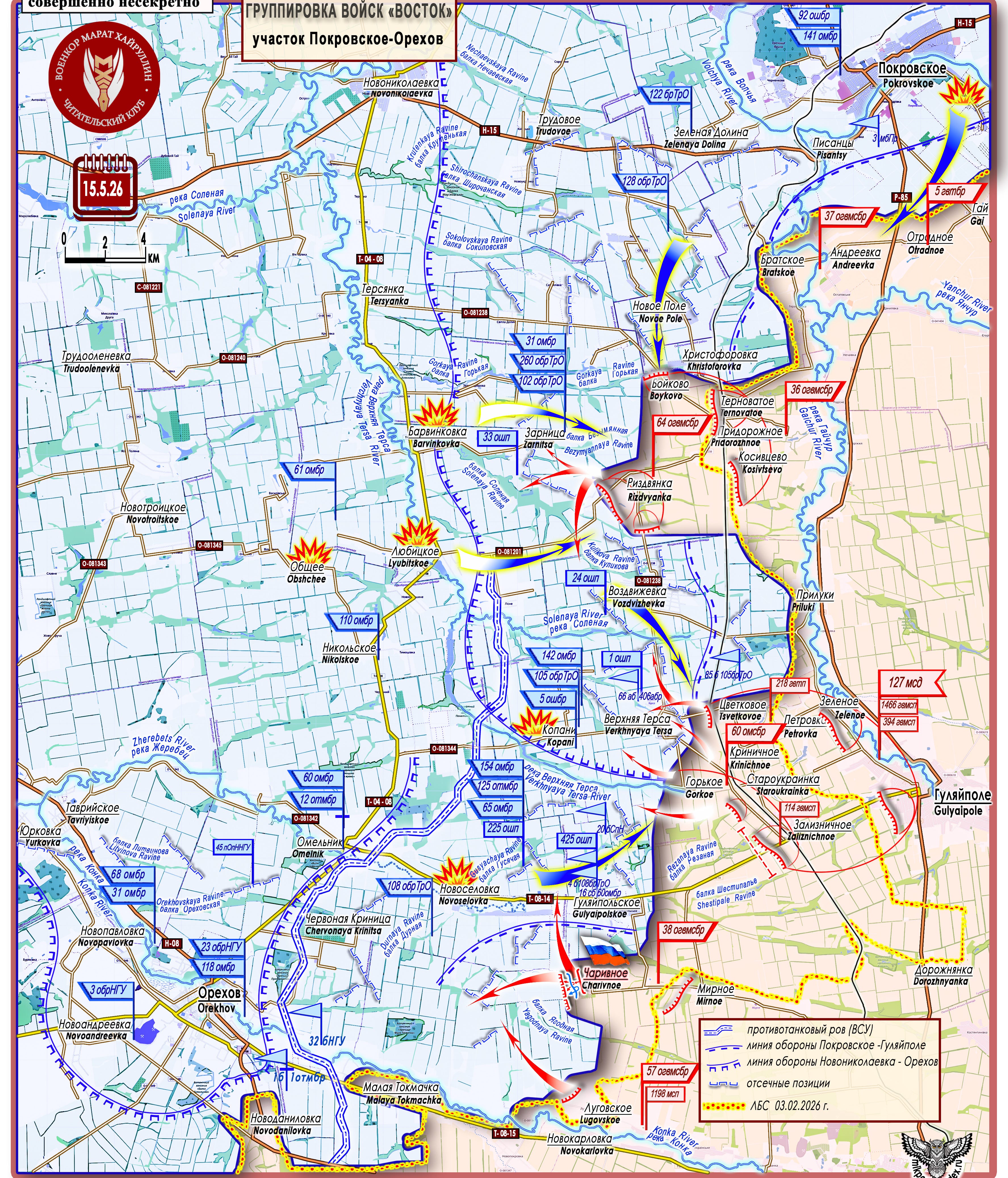
East Group Area of Responsibility; The two solid blue lines with blue dashes between them represent the Anti-Tank ditch in front of Orekhov. The single solid blue line with blue dashes running parallel to it represents the Pokrovskoe-Gulyaipole defense line. The blue arches running along a solid blue line represent the Novonikolaevka to Orekhov defense line. Where you see blue arches facing alternating directions, that represents blocking positions of the AFU. The yellow line with red dots is the line of combat contact as of February 3rd, 2026.
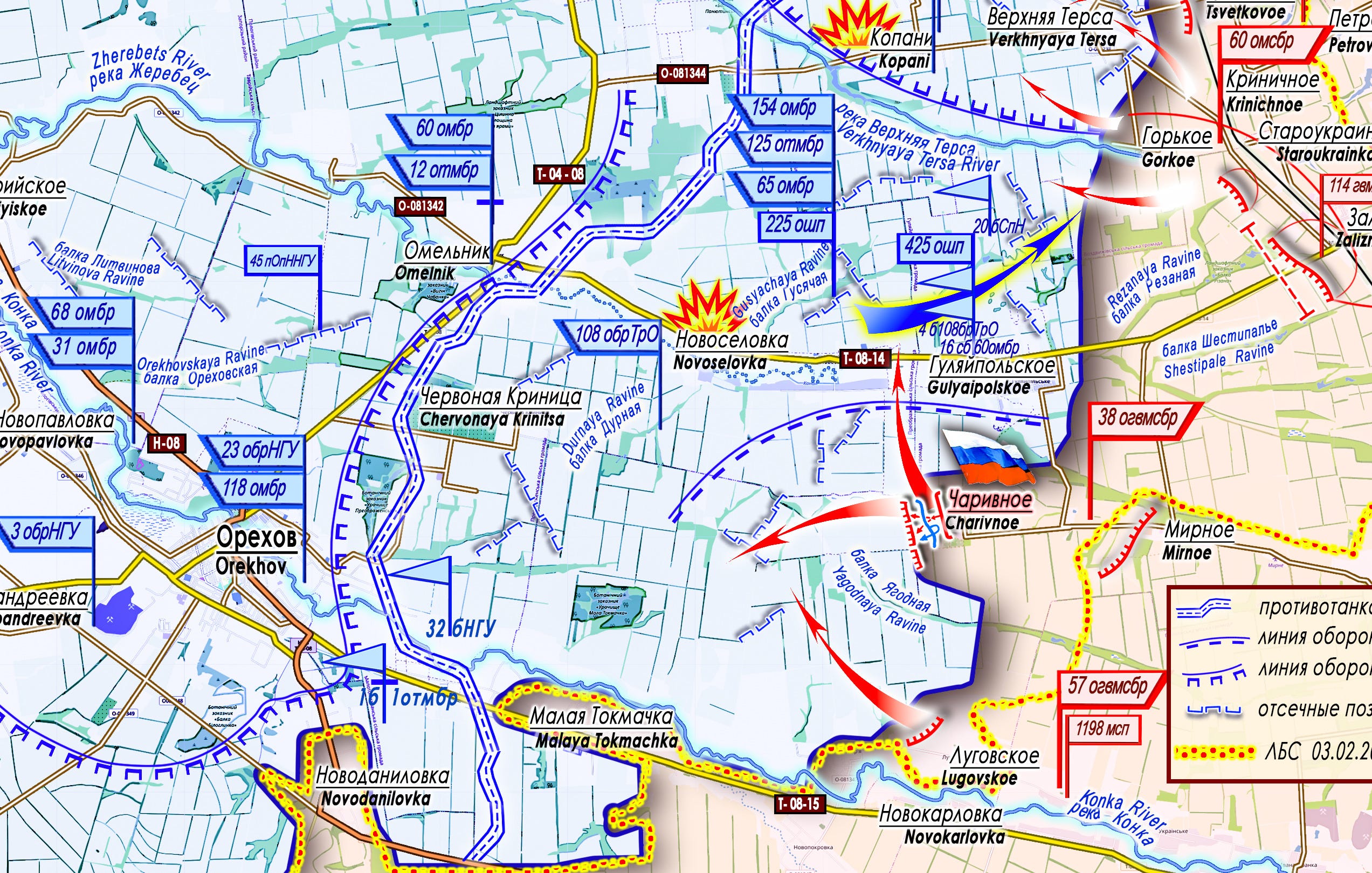
On the eastern sector of the Zaporozhye direction, units of the “East” Group withstood and repelled Ukrainian Armed Forces counterattacks along the entire line of contact, exhausted the enemy in defense, inflicted losses on personnel and equipment, and on May 15 advanced nearly 4 kilometers on the left flank of the sector. They liberated the rural settlement of Charivnoe (47°34′55″ N 36°02′16″ E, population 126 in 2001). The settlement is located on elevated ground in the interfluve of the Zherebets River (its headwaters are at the settlement of Novoselovka and south of the settlement of Gulyaipolskoe) and the Konka River, which slopes westward. [Note: “Interfluve” just means the space between two rivers.]
[

To the south lies the Yagodnaya ravine — relying on it, the enemy has created a network of blocking positions across the space to the settlement of Chervonaya Krinitsa. There are no settlements here; the enemy builds its defense along the tree lines.
With the advance to Charivnoe, the command of the “East” Group is forming yet another tactical salient. Its northern base is the settlement of Charivnoe, and its southern base is Malaya Tokmachka. A threat of flanking envelopment has been created against the Ukrainian Armed Forces’ defense area of Gulyaipolskoe (Komsomolskoe). Through a dividing advance from the settlement of Lugovskoe to the northwest and a converging flanking/outflanking of the Yagodnaya ravine from the settlement of Charivnoe, a threat of encirclement is being created for the Ukrainian Armed Forces grouping defending in the fields to the west.
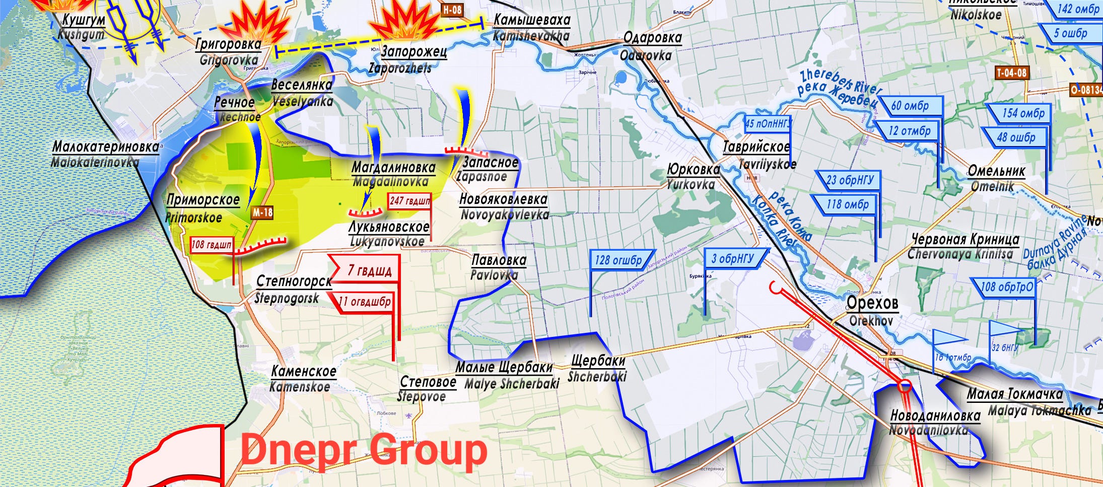
At a time when the enemy has concentrated its efforts on the southwestern sector of the direction (near Primorskoe), countering the advance of paratroopers from the “Dnepr” group to the Malokaterinovka - Veselyanka line, units of the “East” Group have begun clearing the operational space east of the city of Orekhov.
[

Thank you for the updates! o7
Of course sir I am trying to branch out and cover a lot of underlooked blogs across different interest areas, after all this site has been a huge accelerator